
Hays County ZIP Code Coverage
Six primary Hays-associated postal areas anchor the Hays County ZIP code directory: Buda, Driftwood, Dripping Springs, Kyle, San Marcos, and Wimberley. The table also keeps San Marcos post-office-box service and intersecting edge values separate. It is a service-area reference, not a USPS boundary ruling. Run an exact address through USPS before assigning a parcel, resident record, or municipal jurisdiction to any one code.
| ZIP | Areas Covered | Post Office | Notes |
|---|---|---|---|
| 78610 | Buda and northern Hays-associated area | USPS verification | Check the exact address for city, county, and edge boundaries. |
| 78619 | Driftwood | USPS verification | Rural and edge geography, not a municipal boundary. |
| 78620 | Dripping Springs | USPS verification | Hays-associated service area can include edge geography. |
| 78640 | Kyle and surrounding Hays area | USPS, tax, and CAD context | Confirm city limits, ETJ, and the situs parcel. |
| 78666 | San Marcos street-delivery area | San Marcos USPS scheme | A common San Marcos label, but not proof of a city-limit location. |
| 78667 | San Marcos post-office-box use | USPS and Postal Bulletin context | Keep separate from ordinary street delivery and verify current assignment. |
| 78676 | Wimberley | USPS verification | Hays-associated rural and community geography. |
| 78623, 78652, 78656, 78663, 78130, 78737 | Fischer, Manchaca, Maxwell, Round Mountain, New Braunfels, and Austin edge associations | USPS exact-address check | Intersecting context only; do not treat each as wholly or primarily Hays County. |
The Hays County ZIP code directory therefore separates a primary code from an edge association. A postal city can differ from the city government that controls maps, permits, annexation, or ETJ questions. Preserve the code and postal city exactly as returned, then record the parcel's county and municipal context separately.
Note: Treat every edge code as an address-level question until USPS, the parcel, and the relevant municipal source agree.
Hays County ZIP Code Directory Areas
Use the primary entries as broad geographic labels, not as household lists. 78610 centers on Buda and northern Hays-associated territory. 78619 serves Driftwood, while 78620 is associated with Dripping Springs. 78640 covers Kyle and surrounding Hays area. San Marcos has the street-delivery 78666 and a separate 78667 post-office-box context. 78676 is associated with Wimberley. Each label can cross rural land, city limits, or another jurisdictional layer.
San Marcos, Kyle, Buda, Wimberley, Dripping Springs, Hays, Mountain City, Uhland, Niederwald, Woodcreek, Driftwood, and Henly can lead to different municipal contacts for a boundary or address question. For a dated historical address, telephone directories, Sanborn maps, newspapers, and the deed legal description can bridge an older place name to a modern parcel. A current postal code cannot rewrite a historical address label.
Hays County ZIP Boundary Differences
Common misconception. A ZIP does not prove that an address lies inside a city or even entirely within Hays County. USPS assigns delivery labels, while county GIS, appraisal records, and municipal maps describe different geography. County GIS assigns 9-1-1 addresses for most of the county and maintains road and address data with CAPCOG. Municipalities maintain their own planning and boundary information. That division explains why an edge result needs more than one source.
A Hays County GIS/Open Data Hub parcel layer can help establish location and road context. The San Marcos interactive maps add municipal map context. They do not replace USPS delivery verification, and a map boundary does not say who receives mail or lives at a property.
Hays County Tax Searches by ZIP
The Hays County Tax Office Advanced Search is the documented official ZIP-capable property route. It can narrow tax-account results by city, ZIP, property type, owner or business name, tax year, and legal description. A returned account is not a complete list of people receiving mail in that area, and it does not establish legal title or current occupancy. For a title question, compare the result with a recorded document and the parcel's legal description.
| Search field | Use in a ZIP search |
|---|---|
| ZIP and city | Narrow a tax-account search while preserving the postal and municipal distinction. |
| Property ID or CAD ID | Repeat a known account search with a stronger identifier. |
| Street number range and street name | Refine a location once the delivery area is known. |
| Property type, status, and tax year | Limit account context using the available live controls. |
| Owner or business name | Locate an account lead, not a confirmed resident. |
| Legal description, subdivision, block, tract, or lot | Connect a result to the recorded parcel description. |
The official advanced-search screen displays the ZIP, city, property, owner, year, and legal-description controls.
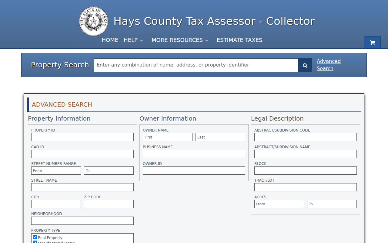
Use the displayed filters to locate account context, then check the live result for available years, status, and current field labels.
The Hays CAD Taxpayer Portal showed a May 13, 2026 update date, while the district's April 27, 2026 CAMA procurement notice signaled that screens or historical presentation may change. Keep the public tax search separate from an authenticated taxpayer account and record the date of each field check.
Note: A tax-account result can narrow a property search, but it does not prove title, delivery, or current occupancy.
Verify a Hays County ZIP Code
USPS is the current delivery verifier. Enter the complete street address in the USPS ZIP Code Lookup, note the returned postal city and ZIP, and compare it with the tax account, Hays CAD, county GIS, and an applicable municipal map. If the sources differ, retain the disagreement. It may reflect a mailing convention, boundary difference, parcel update, or historic address form rather than an error that should be silently corrected.
The USPS address and city-state lookup is the official starting screen for delivery verification.
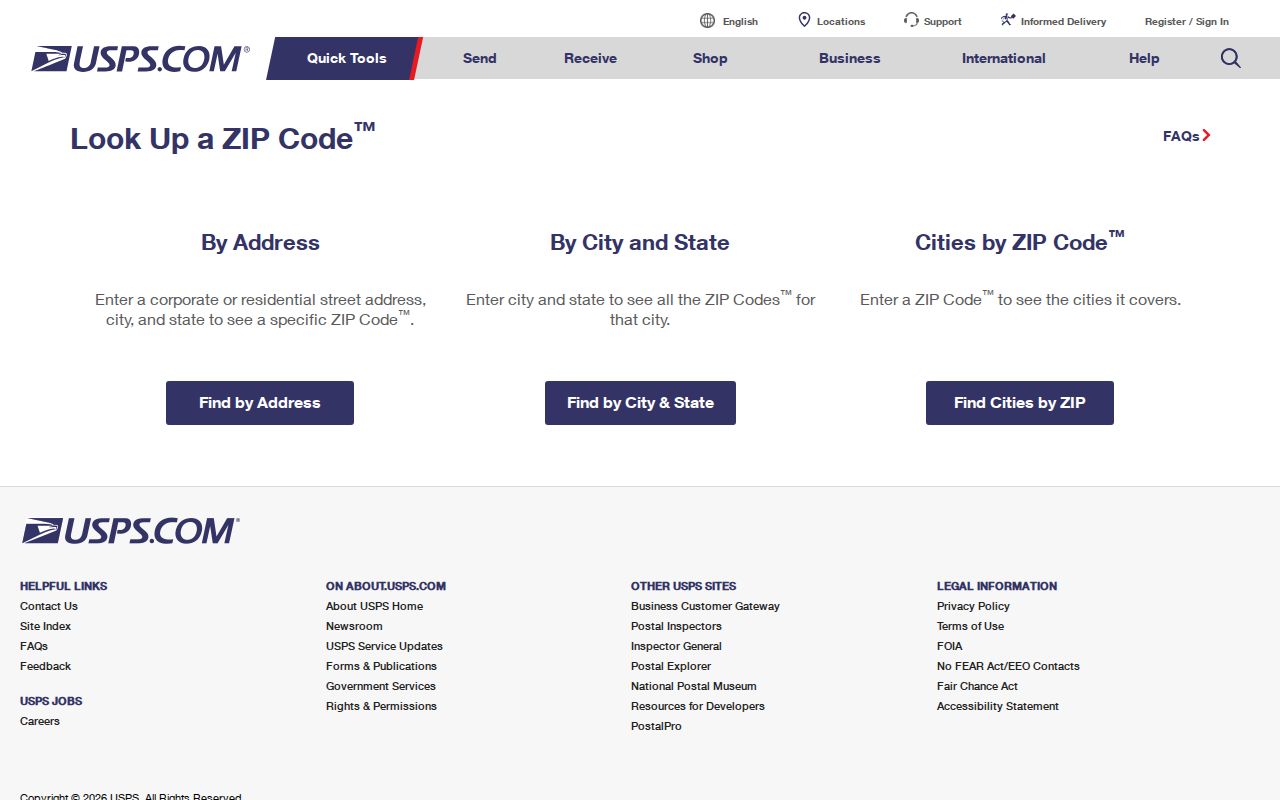
The returned postal assignment should be recorded alongside, not substituted for, the parcel and municipal records used for the next step.
Find Residents by Hays County ZIP Code
A ZIP can narrow an address-based record search, but it does not identify every resident. The tax portal is the clearest documented ZIP filter. Hays CAD's basic search is owner, address, and ID oriented, while the county voter lookup requires an individual name or VUID plus date of birth rather than a visible ZIP field. Use the postal code to organize the location first, then move to the record source that actually accepts the available information.
- Verify the exact address with USPS and save the returned postal city and ZIP.
- Search the Hays tax portal with ZIP, city, street, year, property, or legal-description filters that fit the question.
- Compare the selected account with Hays CAD and county GIS, labeling the situs and any mailing address separately.
- Use an official name-based source only after an exact name and required input are available, and save its query date and limits.
Once a ZIP narrows the area to a road or parcel, the Hays County street directory provides the address-keyed sequence of CAD, GIS, deed, and historical sources. A ZIP-wide tax query is still an account search, not a directory of occupants.
Hays County ZIP Directory Record Limits
Postal geography is broad. It should not be used to expose voter, vital, parcel, or family details merely because a search can be narrowed by area. The Hays voter lookup requires protected inputs and can suppress protected addresses. A CAD or tax account can show an assessment name, mailing clue, and parcel context, but not a verified household roster. Historical directories and newspapers can place a person or subscriber at a dated address, not establish present residence.
For a non-exempt administrative map or address record that is not online, use the responsible county or city request channel. A Texas Public Information Act request should name the custodian, record category, date range, and requested inspection or copy format. The request is for existing records, not a custom ZIP-based profile. Keep a response date and distinguish an unavailable portal from a record that is legally restricted.
Note: Preserve the requested record category and date range so a later search can distinguish a legal limit from a missing result.
Hays County Postal History
Addresses change through annexation, subdivision, road work, rural-route conversion, and local renumbering. The reviewed sources did not identify one countywide readdressing project or a complete year-by-year renumbering list. For an older address, preserve the original wording, then compare its directory entry, Sanborn map, deed legal description, tax parcel, GIS road layer, and municipal address lookup. That chain is more reliable than forcing a historic address into a modern postal label.
The documented historical layer includes San Marcos Library ResCarta scans, a 1941 telephone-directory PDF, Texas State's 1918-2019 telephone-directory collection, and the Local History Room. These sources can move from an address to a listed subscriber or occupant for a specific year. They are not current postal or occupancy databases. A Hays County directory entry should therefore retain the historic source year and distinguish it from the address returned by USPS today.
Older Hays descriptions may use a ranch name, a mileage note from town, or a road endpoint instead of a modern street number. Test those words in the dated directory or newspaper before applying a current ZIP. The original wording can be the key that connects a historical listing to a parcel or legal description.
Hays County Postal Boundaries and City Limits
ZIP boundaries, city limits, ETJs, county lines, parcel polygons, and legal descriptions answer different questions. San Marcos can have a street-delivery label while 78667 is handled separately for post-office-box use. Buda, Kyle, and edge-code areas need address-level comparison because mailing conventions can cross a municipal or county boundary. Use the code to begin a geographic search, then rely on the appropriate parcel, GIS, city, or recorded-document source for the question at hand.
- ZIP versus ZIP+4
- A ZIP identifies a delivery area; ZIP+4 adds a more precise delivery segment for a particular address or mail-receiving point.
- Post-office-box ZIP
- A postal code used for boxes at a post office, which may differ from the code used for street delivery.
- Unique ZIP
- A ZIP assigned to a single institution or high-volume receiver rather than a normal broad delivery area.
- Carrier route
- A mail-delivery sequence used within an area; it is not a city-limit or property boundary.
Note: Postal assignment can change, so verify an important current address with USPS and retain the date of the lookup.