
Walk a Hays County Street
A useful Hays County street directory search follows records in the order they are keyed, rather than treating one screen as a list of every person on a road. Begin with the current situs address, the property location, and normalize its number, direction, suffix, postal city, and ZIP. The county appraisal and tax systems can return an account or assessment name. GIS then puts that account on a polygon beside a road segment. EagleWeb supplies the recorded-instrument trail. Historical directories can add a dated subscriber clue. Each step answers a narrower question, which is why a street result should preserve the source and search date.
- Search the address in Hays CAD property search. Record the situs address, parcel or account identifier, assessment name, and legal description when displayed.
- Check the same location in the Hays County Tax Office advanced search and the county GIS layer. A mailing address and a property location can differ.
- Use the legal description in EagleWeb. Search the assessed owner as grantee near an acquisition date, then inspect the grantor, reception number, document type, and prior references.
- For a named person only, the Hays voter lookup requires either name and date of birth or VUID and date of birth. It is not an open street roster.
- For an older address, search ResCarta scans, the library, and Texas State telephone-directory holdings for a year-specific subscriber or office listing.
Do not collapse those results into one identity claim. A parcel points to land, an assessment record provides appraisal context, and a recorded deed supports a legal-interest trail. A telephone directory or voter result has its own date and access limits. That separation makes a street-by-street note reproducible when an address has changed or a record is later corrected.
Note: Save the original address, normalized street form, parcel identifier, search date, and source URL so another search can be repeated accurately.
Hays County CAD Street Searches
The public Hays CAD search is the first practical address tool for a Hays County street directory. Its fields can find one address or narrow a cluster of assessment accounts. Assessment ownership does not establish legal title or current occupancy, and the portal labels its values as preliminary research material. When a full address fails, a simpler street-name search can expose a formatting difference. Use the result as a bridge to the tax account, map polygon, and recorded instrument, not as a final household list.
| CAD field | Type | Street-search use |
|---|---|---|
| Owner Name | Optional text | Tests an assessment name with surname or partial variants. |
| Street Number and Street Name | Optional text | Finds one address or a street segment when the input is normalized. |
| Quick Ref ID and Owner ID | Optional ID or text | Repeats a specific account search once an identifier is known. |
| Subdivision, Condo, Neighborhood | Optional list or search control | Narrows a platted or mapped area without defining its legal boundary. |
| Tax Year, Property Type, Abstract | Selector or text | Refines a live result using only options currently shown by the portal. |
The Hays County Tax Office advanced-search screen adds city, ZIP, property type, owner, year, legal-description, lot, block, acreage, and street-range context.
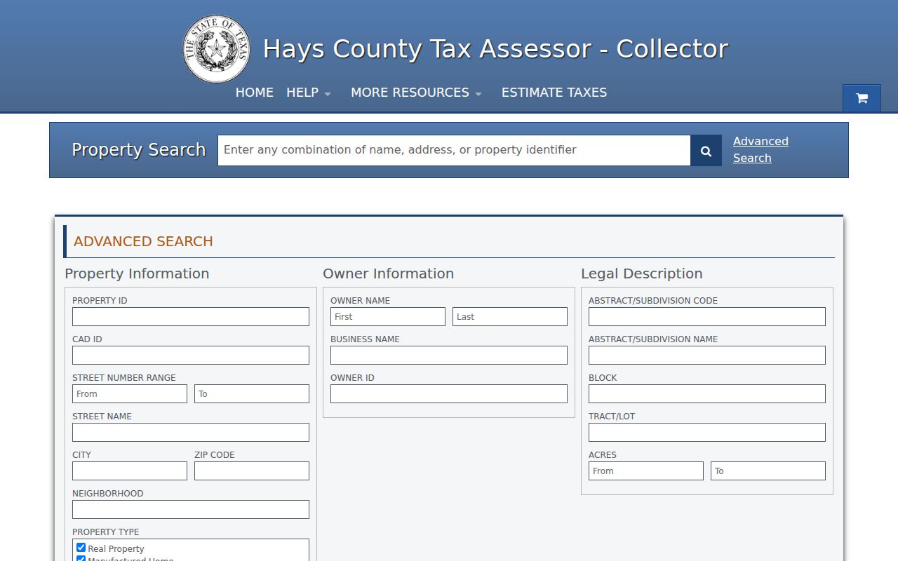
Those filters help distinguish an address search from a broad name search. The account result still needs a CAD, GIS, or EagleWeb comparison before it is used to describe a property history.
Hays County Parcel Map Clues
Map the parcel before interpreting a name. The Hays County GIS and CAPCOG parcel service show polygons, road and address context, and an OWNER_NAME display field. Browse the road, click a selected polygon, and capture its feature or parcel identifier along with the layer date. County GIS uses aerial photos, roads, and address data for 9-1-1 work, so it is particularly useful when a street segment or address assignment is unclear. It is not a complete public list of occupants.
The official Hays parcel feature layer supports standardized queries and JSON, GeoJSON, PBF, and statistics outputs.
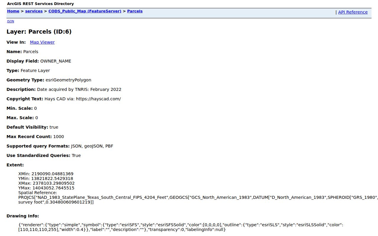
Geometry can establish which parcel fronts a road and which polygons adjoin it. Compare the map display with the current CAD record and legal description because a parcel split, replat, or older layer can make an apparent match incomplete.
For San Marcos addresses, Interactive Maps add permit, zoning, historic-interest, administrative-plat, and address context. A permit may identify a project participant or owner, so it should be dated and never treated as proof of who is presently at the address.
Hays County Street List Limits
A road name does not unlock a complete list of people who live there. Hays CAD, the tax office, and GIS organize information around parcels, accounts, legal descriptions, and map features. The county voter form requires individual identifiers. Texas voter rules also protect some addresses and identifiers. City permit maps provide address and project context, not a general people register. A historical telephone directory may show a subscriber, an office, or an institution for one year only.
The official Hays voter lookup shows the required name or VUID and date-of-birth paths rather than an address-browse feature.
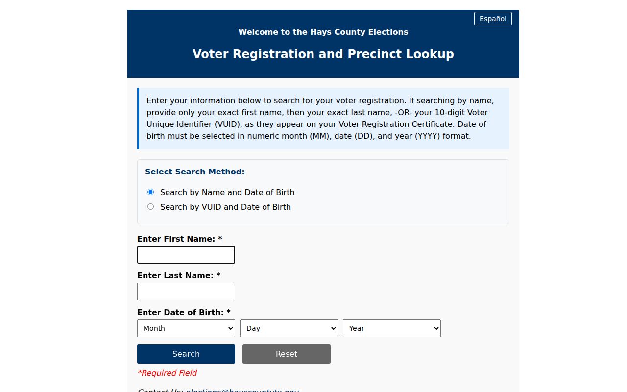
The lookup is useful only after a person has been identified through a lawful, corroborated search. It should not be used to infer a road-wide household list.
That distinction matters on a fast-changing county map. San Marcos, Kyle, Buda, Wimberley, Dripping Springs, and county-only areas can use different municipal routes for address verification, planning, or boundary questions. A postal city or ZIP alone does not settle city limits or extraterritorial jurisdiction. Keep the municipality, map layer, and date with every result, especially for an edge address.
Lawful use. Hays County street and address records support personal, lawful research. Do not use them to stalk, harass, intimidate, or assemble unnecessary personal details about another person.
Hays County Street Deed Chains
Recorded instruments supply the legal-description trail that a street directory cannot provide alone. EagleWeb indexes Hays County documents recorded since August 24, 1848. Start with the parcel ID or lot, block, subdivision, survey, or metes-and-bounds description from the address search. Then look for the current assessment owner as a grantee around the likely acquisition period. The resulting reception number, date, document type, grantor, and prior references guide the next search. A grantor or grantee name is an index term, not an ownership opinion.
The Hays County EagleWeb recorder index offers Grantor, Grantee, Reception Number, Start Date, End Date, Document Type, Subdivision, Block, and Lot fields.
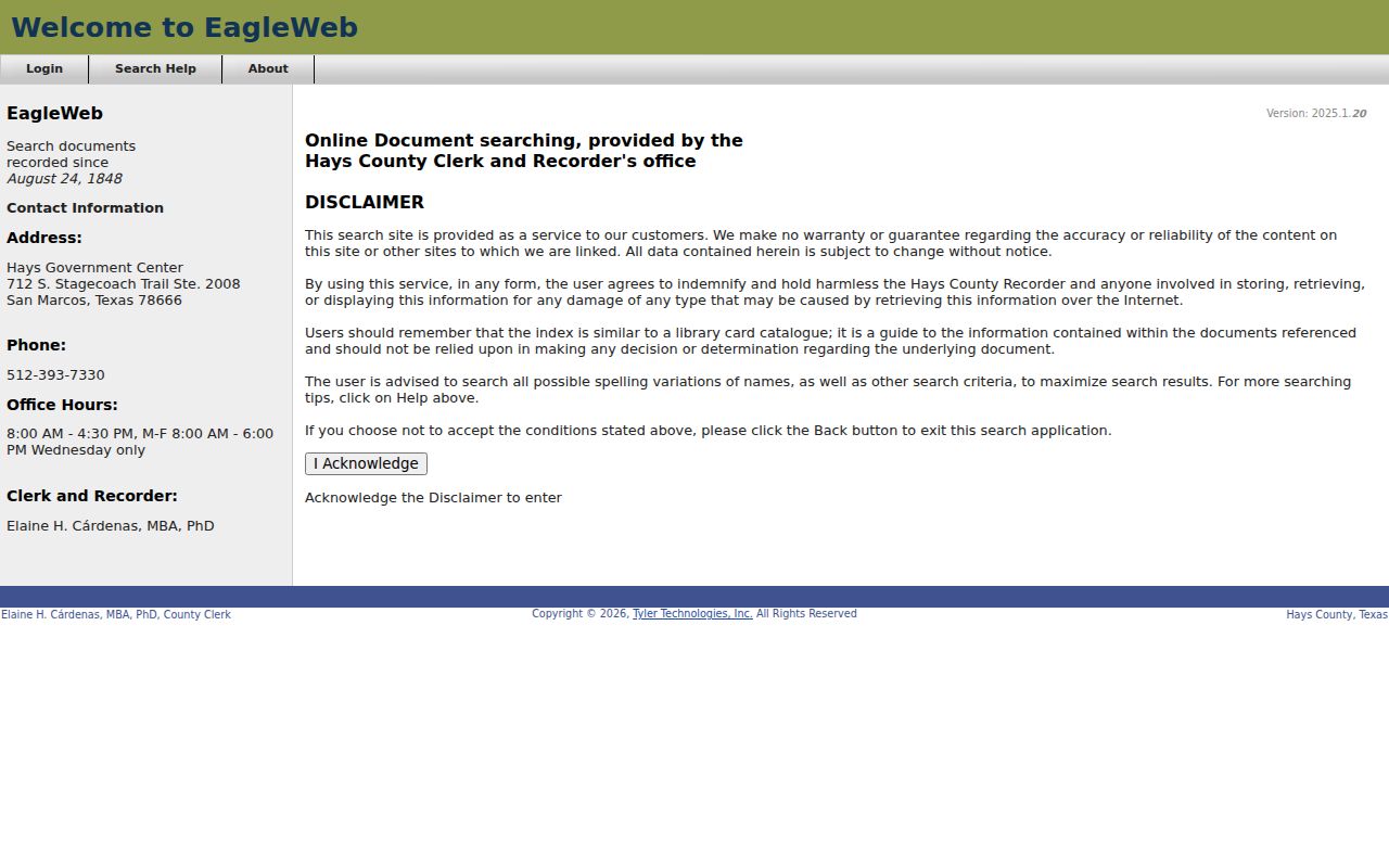
Use the related-document feature and the same legal description to move backward. A deed of trust, release, lien, easement, or plat may explain a reference without being a transfer. The public index is the quick lead; image access can depend on registration or subscription, and the recorded image is needed to evaluate the instrument itself.
When an image or older volume is unavailable online, contact the Hays County Clerk, use its copy or public-information request route, or consult the TSLAC Hays County inventory. TSLAC notes reel-level gaps, and its microfilm may be available through library interlibrary loan.
Hays County Address Labels
Address words are not interchangeable in Hays County records. Mark the kind of address before comparing sources. A mailing address may be outside the county. A legal description can stay stable even when a street number changes. GIS describes mapped geography, while USPS answers a delivery question. Clear labels prevent a useful street-directory trail from turning an old or administrative clue into an incorrect present claim.
- Parcel
- A mapped unit of land represented by a CAD account or GIS polygon. It may be split, replatted, or associated with an assessment name.
- Situs address
- The physical property location used for an appraisal or tax context. It is different from a mailing address.
- Legal description
- The lot, block, subdivision, survey, or metes-and-bounds wording that identifies land in a recorded instrument.
- Plat
- A recorded map that lays out a subdivision or lot configuration and can help connect a street address to a legal description.
- Criss-cross directory
- An address-ordered historical directory section that can lead to a dated subscriber or listed occupant.
Run the exact address through USPS ZIP Code Lookup before treating its postal city or ZIP as current delivery information. Compare that answer with CAD, tax, GIS, and the applicable municipal map. The research found no countywide renumbering project or one numbering grid, so historic and modern street forms should remain separate unless a dated source links them.
Note: A street number can change over time, while the lot, block, subdivision, or survey description may preserve the stronger property connection.
Hays County Historic Street Leads
Older Hays County address work needs a dated local source. The San Marcos Library holds digitized telephone material from 1899 through 1954, while the Texas State University finding aid describes telephone directories dated 1918 through 2019, including nearby Kyle, Buda, Wimberley, Dripping Springs, and Martindale. Rural entries can use a ranch name, distance from town, or a road endpoint instead of a modern number. Preserve the original punctuation, abbreviation, and postal label before attempting a modern interpretation.
The library’s ResCarta collections, its local-history room, newspapers, Sanborn maps, and TSLAC microfilm can bridge an old wording to a parcel. For the collection years, entry conventions, and household-tracing method, use the Hays County city directory collections. A historical listing is evidence that a subscriber, office, or business appeared at a stated place and time. It is not proof of ownership or current occupancy.
If a street name, rural route, or record series fails, log the exact query and reason. A failed postal match can be formatting; a missing polygon can be a layer vintage; and no EagleWeb result can reflect an alternate spelling, jurisdiction, or unindexed material. That note is more reliable than guessing why the record is absent.
Hays County Street Records Compared
These Hays County street directory sources are keyed differently, so they should be used as a chain rather than merged. The first four are official online entries. The last two provide either restricted individual lookup or historical context. Every row has an in-person, request, or archive fallback when an online result is missing.
| Address-keyed source | Keeper | What it can show | Access |
|---|---|---|---|
| Appraisal parcel or account | Hays CAD | Assessment name, situs clues, property ID, subdivision, tax year, and appraisal context | Public CAD search; call CAD for help if needed |
| Tax account or roll | Hays County Tax Office | City, ZIP, tax year, status, legal description, lot, block, acreage, and account context | Advanced Search; confirm current status with the Tax Office |
| GIS parcel and address | Hays County and CAPCOG | Parcel polygons, roads, address context, owner display field, and layers | GIS hub, data forms, phone, or map request |
| Recorded deed, lien, or plat | Hays County Clerk | Parties, reception number, dates, instrument type, and legal description | EagleWeb, Clerk counter, copy order, or public-information request |
| Voter registration lead | Hays County Elections | Individual registration and precinct context when required inputs are supplied | Name or VUID plus date of birth; protected fields remain restricted |
| Historical telephone or reverse directory | Library and Texas State University | Dated subscriber, office, business, or address lead | ResCarta scans, local-history visit, archive request, or off-site box notice |
A record with a similar address is not enough. Match the street form, date, parcel or legal description, and source type before treating two results as the same property trail.
Hays County Street Requests
Online tools are only one access channel. County GIS handles map, data, 9-1-1 address, verification, road-layout, and road-naming forms, and the office can be reached at 512-393-2160. The County Clerk’s Records Division is the route for recorded instruments and copies, while the library and archives handle many historic materials. State archival material can be consulted in Austin or requested through a library interlibrary-loan route when TSLAC permits it.
For a narrow non-exempt administrative record, Hays County accepts a Texas Public Information Act request through its County Clerk page and GovQA route, by mail or hand delivery to the Office of General Counsel, Attn. PIA, 111 E San Antonio St., Suite 202, San Marcos, TX 78666, or by the county’s linked email and fax channels. Describe the address, record category, date range, and whether inspection or a copy is wanted. A request can obtain an existing record; it cannot require an office to create a new street-by-street list.
County Clerk records assistance is available at 512-393-7330. San Marcos Public Library Local History can be reached at 512-393-8200, and its room requires a reservation from 24 hours to 14 days ahead. Ask the holding institution whether a specific directory, reel, or map is digitized, off-site, restricted, or available for a scan.
Hays County Street Directory Limits
The strongest Hays County street directory result is a documented address trail, not a claim about every person connected with that road. Assessment names can represent a trust, estate, business, or other organization. A mailing address can point somewhere else. Voter, vital, motor-vehicle, utility, and other protected information has separate rules or is not a general public street list. Do not publish exact dates of birth, VUIDs, protected addresses, or unnecessary family information.
Use an official source for the purpose it actually serves. CAD and tax data provide assessment and account context. GIS provides geography. EagleWeb provides recorded-index leads. Library material provides historical context. When the goal becomes one person rather than a street, the proper next step is a carefully corroborated individual records search, not an expanded address list.